Severe weather possible Wednesday
Published 9:51 am Wednesday, February 12, 2025
Update: A tornado watch has been issued for 25 Central Mississippi counties, including Lauderdale, Clarke, Kemper, Jasper, Newton and Neshoba counties, until 10 p.m. Wednesday.
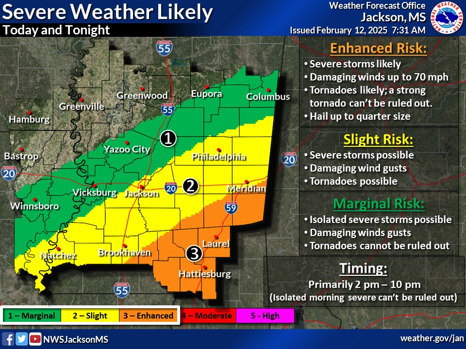
Stormy skies could bring more than rain to the Meridian and Lauderdale County area as the potential for severe weather rises for Wednesday afternoon and evening.
The National Weather Service in Jackson is forecasting the potential for severe weather for a large portion of Central and South Mississippi from Columbus to Hattiesburg. Meridian, which is under a slight risk, could see severe storms, damaging winds and potential tornadoes.
Areas south of Meridian in Lauderdale and Clarke counties face an enhanced risk with tornadoes likely, up to quarter-size hail and winds up to 70 miles per hour, according to the forecast.
Rain, which is expected to continue throughout the day, has prompted a flood watch for four East Mississippi counties, including Lauderdale, through 6 p.m. The Meridian area could see as much as 2-4 inches of rain, causing flash flooding in low-lying areas and places with poor drainage.
In a social media post, The Mississippi Emergency Management Agency encouraged residents to have an emergency plan in place in the event of a storm, have multiple ways to receive severe weather alerts and not to drive through flooded areas.
For more information about severe weather preparation, visit msema.org.


