Tornado watch issued for East Mississippi through Sunday evening
Published 11:50 am Sunday, April 19, 2020
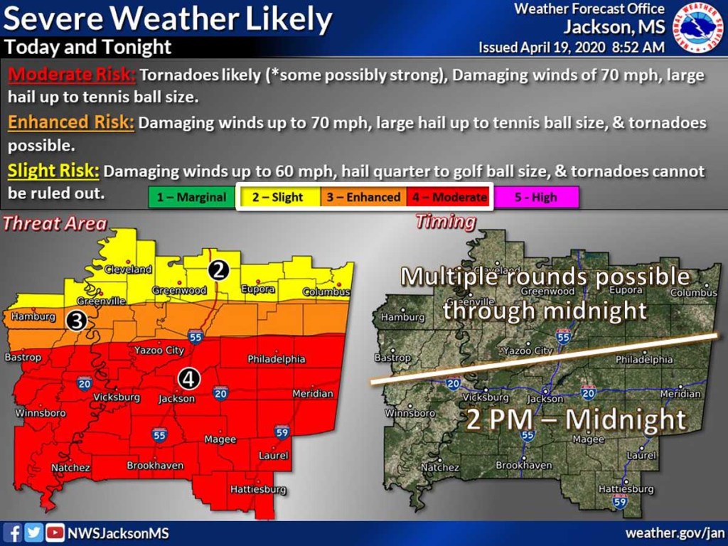
- A tornado watch has been issued for East Mississippi through Sunday evening.
The National Weather Service has issued a tornado watch for most of Mississippi through 7 p.m. Sunday.
East Mississippi counties in the watch area include Clarke, Jasper, Kemper, Lauderdale, Neshoba and Newton.
Significant severe thunderstorms are anticipated through Sunday night and tornadoes are likely with strong tornadoes possible, according to the weather service.
Some thunderstorms could also produce damaging winds up to 70 mph and large hail up to tennis ball size, according to the hazardous weather alert.
The same counties are also under a flash flood watch through 1 a.m. Monday.
Areas of flash flooding are likely and some roads could be flooded or closed, according to the alert. Some structures may be potentially threatened by high water. Minor river flooding is also possible.
Some of the storms Sunday could produce heavy rainfall. New rainfall amounts between 1 and 2 inches are possible Sunday into the night.
The threat of thunderstorms in Meridian is greatest between 2 p.m. and 6 p.m., according to the forecast.